We are offering training and certification opportunities for the NAACC non-tidal aquatic connectivity module in April and May 2024. Click here to learn more and register.
AQUATIC CONNECTIVITY & STREAM-CROSSING SURVEYS
Some people look at road construction as an inconvenience — a traffic delay or a detour. BEAT looks at road construction as an opportunity!
It started with efforts by the State to remove dams from our streams and rivers. Free-flowing waterways provide better habitat for many wildlife species — especially cold-water fish species. One problem with dams is that they are obstructive. They are an obstacle to fish and other aquatic animals, often preventing them from freely moving upstream or downstream.
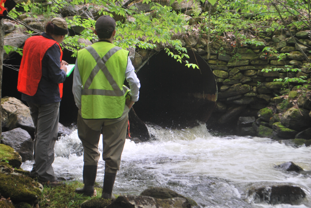
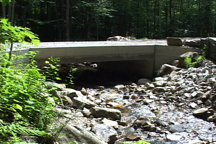
Well, it turns out that so are many culverts — those concrete, metal, or plastic pipes or other conduits that carry water under roadways. Look at the picture below.
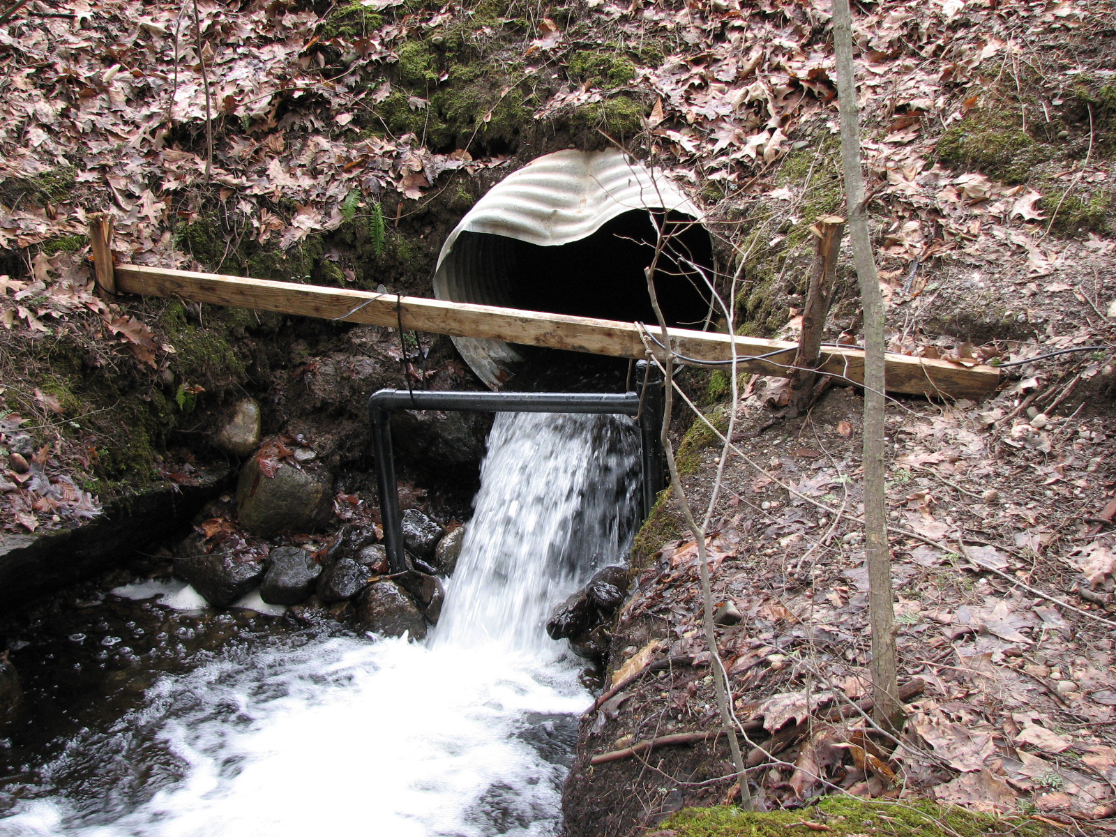
This culvert may not look like it poses a threat to wildlife, but imagine you’re a small fish, insect larva, or amphibian trying to get up this stream. This freefall might as well be Niagara Falls in front of you.
Another problem with many of our culverts is that they are just too small for the task. When an undersized culvert is installed under a roadway, the water may pass through just fine 90% of the time. But what happens in times of high water? When a culvert is too small to handle the amount of water trying to pass through it, the excess water has to go somewhere. Often, it goes around the culvert and up onto the roadway. Sometimes, the excess water squeezes between the culvert and the soil, following the outside of the culvert instead of the inside. This erodes the soil under the roadway and can cause safety issues.
Another less obvious problem related to undersized culverts is that they restrict the flow of nutrients. Headwaters — the small streamlets and brooklets that are the source of our watersheds — provide most of the nutrients in the water and in the sediments. Leaves, dying insects, and other natural materials collect and decay in the water, adding organic nutrients as streams begin their flow toward the ocean. However, unnatural constrictions in a streambed can result in restricted downstream flow of these nutrients.
For this reason, BEAT has been working to survey all stream crossings in Berkshire County (i.e., all places where a roadway crosses a stream). There are a lot of them. The estimate is that there are about 2,100 of these crossings in the county.
BEAT’s volunteers, interns, and partners are surveying these crossings as part of a project organized by the University of Massachusetts. If you would like to volunteer to help survey crossings, email us at team@thebeatnews.org.
NAACC SURVEYING
The North Atlantic Aquatic Connectivity Collaborative (NAACC for short; pronounced “nack”) is a participatory network of practitioners united in their efforts to enhance aquatic connectivity.
Thus far, the NAACC has:
- Developed a unified protocol, electronic data form, scoring system, and database for road-stream crossing assessments that can help identify bridges and culverts that are problematic from an aquatic connectivity perspective
- Launched an in-person and online training and certification program to ensure data quality
- Created an online database that serves as a common repository for crossing assessment data, including data collected by assessment protocols that pre-date the NAACC
- Developed web-based tools to identify high-priority watersheds and crossings for assessment and to prioritize crossings for upgrade or replacement
- Encouraged and supported efforts to conduct crossing assessments throughout the region
- Begun development of additional crossing assessment modules, including aquatic passability for tidal streams, terrestrial wildlife passability, and culvert condition
All of the collected data from stream-crossing surveys gets entered into the NAACC database, which is maintained by UMASS and is an invaluable resource for organizations that are working to protect wildlife habitat, improve wildlife movement, maximize motorist safety by reducing vehicle wildlife collisions, and minimize the ecological footprint of roadways by improving landscape connectivity.
TERRESTRIAL CONNECTIVITY
In addition to stream-crossing surveys, BEAT also assesses crossings for terrestrial wildlife passability using the NAACC protocol. Similarly to aquatic surveying, these assessments are done at road-stream crossings, and the surveying for terrestrial and aquatic is very similar, with only a couple of different measurements needing to be taken. These road-stream crossings are great locations for planning and implementing infrastructure that supports safe movement of terrestrial wildlife because there is often already some kind of infrastructure in place and a tunnel of some kind has already been made underneath the road.
Additionally, BEAT will sometimes use the habitat linkage assessment that Follow the Forest, an initiative of Housatonic Valley Association (HVA), created for areas of road that don’t have a road-stream crossing underneath but are still intersecting core terrestrial habitat. Check out Follow the Forest’s interactive “story map” at this link.
If you would like to get trained and certified in the NAACC protocols so you can aid in our efforts to survey all the road-stream crossings in Berkshire County, please email Chelsey at chelsey@thebeatnews.org.
MORE ON CULVERTS
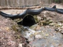
The University of Massachusetts, The Nature Conservancy, and the Massachusetts Division of Ecological Restoration have created a set of standards for designing culverts. These standards have been adopted into the regulations of the MassDOT and the Army Corps of Engineers. The standards ensure that culverts will not create artificial waterfalls that hinder aquatic migration. They will also be open-bottomed wherever possible so that the substrate within the culvert matches the substrate of the streambed. Culverts must be wider than the actual streambed. Specifically, culverts must be 1.2 times the width of the streambed. This extra width, which will be dry except in times of very high water, provides a path for non-aquatic wildlife such as raccoons, mink, porcupines, and in some of the larger waterways, deer and bear. There are also other guidelines within the new regulations. The idea is that a fish swimming upstream should not notice any difference in the stream when it swims under the road, other than a passing shadow. Check out these two “before” and “after” pictures taken in Windsor.
Under these new regulations, municipalities that are doing roadwork that involves a culvert are encouraged to replace the culvert with one that meets these new standards. Municipalities are not being made to dig up roadways just to upgrade deficient culverts, but if they are replacing a culvert, they must replace the existing culvert with one that meets the new standards. Because of the stream-crossing survey, each road construction project that involves a culvert becomes an opportunity for improvement in wildlife movement, habitat connectivity, and public safety. Culverts that meet all of these guidelines will allow easier migration and movement of aquatic and terrestrial wildlife, which is especially important in this time of climate change.